


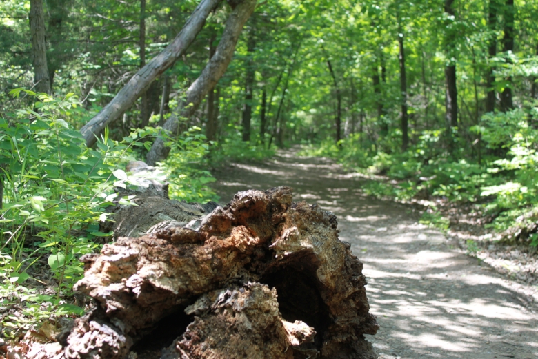
Topeka's trails will provide you with Insta-ready views or help you connect with different neighborhoods like a local. Whether you're hiking solo or building memories with family and friends, trails provide opportunities for recreation, exercise and even relaxation for people of all ages and abilities.
Use the following guide to find the perfect trail for your next adventure. For a PDF map of Shawnee County Parks + Rec trails click here.
Short Trails
.3-mile concrete pedestrian path. You'll also find an open-air shelter, pay structure, drinking fountain and multi-purpose tennis/basketball court.
Betty Phillips Park
.44-mile paved Trail
.5-mile single-track trail through a red cedar forest. Features a fishing pond with barrier-free fishing dock.
.75-mile concrete pedestrian path.
Iliff Commons
Moderate difficulty
1.66-mile hiking trail that winds through the prairie and affords a beautiful view of downtown Topeka and the Kaw River valley toward the southwest. The native prairie and woods of the Iliff Commons have never been developed unless you count numerous squatters during the Bleeding Kansas era before the Civil War-- who built dugouts or rude log cabins only to have them burned down by soldiers from Ft. Leavenworth! The Commons was a portion of the Kaw Half-breed Reserve No. 7, deeded to Marie Gonvil by a treaty in 1825. Marie was the daughter of Kaw Chief White Plume and the wife of Pierre Gonvil, a French trader who settled in the area. The 23 Reserves, which stretched along the north bank of the Kaw River from Topeka to Lecompton, were made an “unalienable” gift to 23 mixed-blood descendants of White Plume by the U.S. government.
That did not prevent the owners from selling them to white settlers during the territorial period, often multiple times. Andrew Reeder, the first territorial governor, was sacked by President Franklin Pierce in part for speculating in these lands, which were valuable for their timber. Timber was scarce south of the river, but abundant to the north. Because the deeds were unalienable, sales inevitably reverted to the original native owners; in fact, a clear title could not be obtained until the 1980s, when Topeka judge Franklin Theis finally ruled that enough time had passed to abrogate the original treaty.
Dr. and Mrs. Iliff bought 80 acres from a developer to preserve the land in its native state. The prairie, after years serving as neglected pasture, is gradually being restored by burning and reinstitution of native species. Several miles of trails have been carved through the grass and woods to serve as walking, running, cross-country skiing, and mountain biking courses. A replica of Topeka’s original log cabin lies on the trails and is available for overnight visits by organized groups.
Wildlife includes deer, wild turkey, fox, bobcat, and the usual assortment of common critters. Red-tailed hawks and bald eagles patrol the prairie. Visitors are welcome from dawn to dusk every day of the year. Parking is available inside the entrance on the south side of NE 31st just east of Kincaid. Access to 31st is from Happy Hollow on the west, and K-4 on the east. Please respect the land, and do not take motorized vehicles past the barrier posts.
Oakland-Billard/Santa Fe Park Trails
1.6-mile paved trail
1.8-mile paved concrete bicycle/pedestrian trail from Garfield Park to NW Lyman Road.
Medium Trails
2-mile trail located west of Forbes Field. This natural surface trail runs through 80-acres of virgin prairie that has never been plowed. The area includes hundreds of native prairie species, some of which are scarcely found elsewhere in the state.
2-mile mowed grass and natural surface single-track trail following Shunga Creek from SW Gage to Shunga Glen. The mowed grass is very popular for bird watching as well as viewing aquatic wildlife.
2-mile trail from SE Golden to SE 6th and SE 6th to SE 10th. This 10-foot wide concrete pedestrian trail is located in East Topeka, with the north end of Deer Creek Trail being connected to the Shunga Trail.
2-mile natural surface trail on undeveloped parkland comprised of grasslands and wooded areas. a .8 mile paved perimeter trail encircles the west side of the park. This trail is popular with walkers, runners and cross country skiers.
Gage Park Fitness Loop Trail
2-mail paved trail encircling the park and crossing over Westlake via a bridge.
Welton Grove Park
3 miles of natural surface trails.
Long Trails
4 miles of natural surface trails beginning at SW 25th and Gage east of Felker Park. The trail includes a wetland to slow and clean runoff water from streets and neighborhoods. Many birds, mammal s and aquatic species can be found here. This area is the top spot in the Topeka park system for viewing birds and insects.
4.47-miles (four single track) of natural surface trails through wooded and prairie areas. The summit trails provide an aerial view of the city of Topeka and surrounding areas. Skylilne Park is the home of Burnett's Mound.
North Summit Trail
Easy to Intermediate difficulty
Average Grade: 2%
Max Grade: 9%
1.5-mile loop. This casual loop travels to the north end of the park and has great views. on a clear day, you can see Jeffrey Energy Center in St. Mary's, KS.
Sunrise Trail
Easy to Intermediate difficulty
Average rade: 3%
Max Grade: 11%
1.1-mile loop. This trail has great views and rolling elevation that makes for a short interesting loop through the trees no matter what direction you are hiking. Watch for a small creek-like crossing. This trail is popular with mountain bikers so be alert as you hike.
South Summit Trail
Easy to Intermediate difficulty
Average Grade: 3%
Max Grade:8%
.6-mile trail. Head through the rockiest part of the trail system with a cedar boardwalk feature in the middle. This trail is popular with mountain bikers so be alert as you hike.
Sunset Trail
Easy to Intermediate difficulty
Average Grade: 3%
Max Grade: 12%
.8-mile trail. This trail heads through the southwestern part of the Skyline Park trail system. It is mostly free of rocks making for pleasant hiking.
Easy hike
Average Grade: 0%
Max Gade:1%
4.75-mile paved and gravel trail along an abandoned railroad track running from SE 15th to SE 45th. The trail begins at historic Brown V. Board of Education National Park near Downtown Topeka. With a portion being paved from 17th to 45th street its a nice hike for families with young children or toddlers in strollers.
7-mile paved concrete pedestrian/bicycle trail that encircles Lake Shawnee. This trail offers scenic views o the lake and passes by the Lake Shawnee Overlook, Ted Ensley Gardens, Lake Shawnee Golf Course and Bettis Family Sports Complex.
Average Grade: 0%
Max Grade: 5%
8.5-mile paved concrete pedestrian/bicycle trail begins at SW29th and McClure (west of Fairlawn) and continues east to SE 2nd. The 10-foot wide path runs along the Shunga Creek Corridor through parks, residential areas and into the downtown area. There are multiple access points which make this ideal for families with young children or babies in strollers.
7-miles of natural surface trails through wooded area accessible from SE 25th and Highland. The trail has evolved from prairie to hardwood forest. Several trails meander along Deer Creek in heavily forested, rolling terrain. Near the trailhead, you can see the remnants of old stone dairy buildings. on the south side fo the park, trails also wind through wide-open prairie grasses.
The MacLennan Park Trails are located in northwest Topeka along the hills overlooking the Kansas River. Trailhead access and parking lots may be found on the south side of the park on 6th Street west of Fairlawn Road and on the north side of the park on the west side of the Governor’s Mansion. The park has two types of trails – a wide limestone loop and a series of dirt single-track hiking and biking trails.
Beginning at the north parking lot on the west side of the Governor’s Mansion, the 2 mile limestone path drops into the timber and arcs toward the southwest, then skirts the edge of the prairie grass along 6th Street on the south and Fairlawn Road on the east, then turns to the west along Cedar Crest Drive where it rejoins the parking lot on the west side of the Governor’s Mansion. The limestone path may also be accessed from the south parking lot located on 6th Street just west of Fairlawn Road.
The entrance to this trail is located north of SW 6th street, about 1/2 miles west of Fairlawn road. This urban state park consists of 76 acres of beautiful land adjacent to MacLennan Park and Cedar Crest (Kansas Governor's Mansion). The Kansas River is also accessible for canoes, kayaks and other small craft from a boat ramp and parking area on the north side of the park. Deer, Turkey, and numerous other wildlife species are common in the surrounding forest.
Red Trail
Easy to Intermediate difficulty
Average Grade: 4%
Max Grade: 12%
2.7-mile loop which is probably one of the most popular trails in the trail system on the east side of the park. It goes along the west side of Fairlawn and the north side of the Governor's mansion. There are offshoots around so you can choose to make your own path. May have small rocks and roots.
Yellow Trail Central Loop
Easy hike
Average Grade: 4%
Max Grade: 11%
1.7-mile trail point to point.
Yellow Trail West Loop
Easy to Intermediate difficulty
Average Grade: 4%
Max Grade: 12%
1.1-mile trail. May have small rocks and roots.
Yellow Trail East Loop
Easy hike
Average Grade: 1%
Max Grade: 4%
1.1-mile trail point to point.
If you're new to hiking, the American Hiking Society compiled a list of commonly observed practices to help make your excursion fun and memorable.
- Hike quietly and enjoy the sounds of nature
- If taking a break let others pass by you unobstructed
- Don't toss your trash even if it's biodegradable
- If you bring a pet keep it on a leash, under control and pick up pet waste
- Don't feed the wildlife
- Leave what you find
- If hiking in a group don't take up the whole width of the trail and let others pass
- Don't walk off the trail - it's bad for trail sustainability
